San Diego Wants Your Input on Streets for All Plan

How do you feel about the design of your street? Is the city doing enough to make your commute safe? What more could they be doing?
Last month, the City of San Diego’s planning department released a draft of its Streets for All manual and is giving you a chance to tell them what you think about their approaches to make the city’s transportation grid work for everyone. The survey is open through Friday, November 13, 2026. Get started, here.
The Streets for All manual is intended to address a familiar problem in San Diego neighborhoods: streets designed primarily to move vehicles often leave people walking, biking and rolling with too little space and too little protection. Despite efforts to make spot improvements in the most dangerous intersections in the city and efforts to build a bike network piecemeal as resurfacings occur, the city has made little progress in achieving its Vision Zero goal of eliminating deaths caused by automobiles.
The city declared Vision Zero in October of 2015. That year, the city experienced 132 “severe collisions” and 46 deaths caused by driving. Ten years later in 2025, those numbers were 120 and 50 respectively.
The manual offers a framework for addressing one of the main causes of Vision Zero’s failure by treating streets as public spaces that serve more than one purpose, while giving neighborhoods practical options for slowing traffic and making streets more inviting for all road users.
“When talking with San Diegans, one concern comes up again and again: the safety of the streets in their own neighborhoods,” says BikeSD Executive Director, Anar Salayev.
“People see drivers speeding, running stop signs, and failing to yield to pedestrians. That persistent behavior makes it harder to comfortably walk around the block, reach a nearby park or school, or simply feel at ease outside their homes.
If we want to reduce car dependence, we have to start with the smallest unit of daily life: the neighborhood. Streets for All can help close that gap by giving residents more tools to shape safer, slower streets and a greater sense of ownership over the improvements in their communities.”
The Manual
A quick note that the Streets for All manual has no relationship to the non-profit advocacy group Streets for All that has offices in Los Angeles, San Francisco, and Sacramento.
The draft identifies three types of streets that communities could pursue:
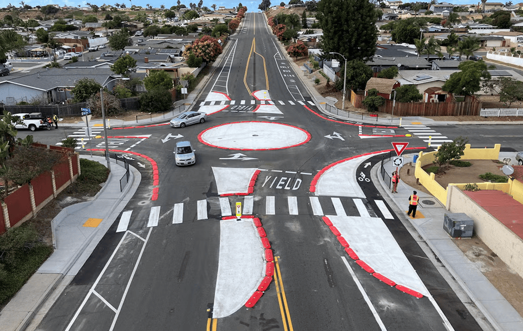
- Residential Healthy and Connected Streets: Streets that prioritize walking, biking and rolling while maintaining vehicle access at slower speeds. The city uses the roundabout at Del Sol Boulevard and Kostner Drive in Otay Mesa, which helps slow vehicles for people walking and riding as an example of a road treatment that could be applied in more places.
- Residential Calm Streets: Streets where vehicle traffic could be partially or fully restricted to create more room for walking, biking, playing and neighborhood gatherings. The city identifies traffic calming (narrowed lanes, speed humps, etc.) as the preferred treatment. Unlike a Healthy and Connected Street, which maintains regular vehicle access, a Calm Street puts greater emphasis on reducing vehicle volumes and reclaiming street space for neighborhood life.
- Business Healthy and Connected Streets: Commercial streets designed to provide more space for outdoor dining, walking, biking and community activities while maintaining slower vehicle access and room for deliveries. For example, a neighborhood business district could be redesigned with wider sidewalks, protected bicycle space, traffic-calming features and designated areas for outdoor dining or gathering. The goal is to make it easier and more enjoyable for people to visit local businesses without eliminating vehicle access, including space for deliveries.
The manual includes photographs, illustrations and descriptions of potential traffic-calming treatments to help residents understand what different improvements might look like in practice.
The City has also developed a preliminary network map showing streets that could meet the criteria for these improvements. However, the map is intended as a starting point for discussion, not a list of streets already scheduled for construction. Communities can recommend other streets to be designated as well.
“The Safe Streets for All framework signals that the city is serious about wiring with its constituents to build a San Diego that chooses safety in a way that reflects the specific circumstances of each neighborhood,” writes Haylee Rea with Strong Towns San Diego.
“The potential of this plan, if key roadblocks are addressed, would allow San Deigns to move the needle towards a safe, prosperous and connected city.”
Why Are Some Concerned?
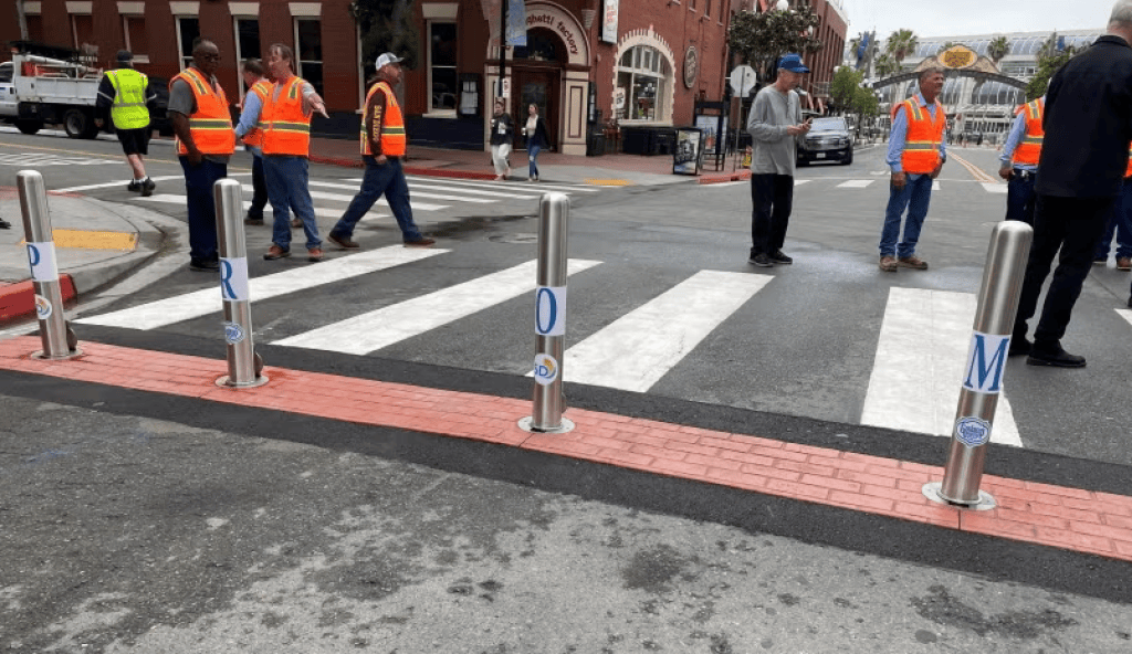
But despite rosy language from the city and hope from some advocates that the manual can be a catalyst for positive change, others worry that the City’s efforts-to-date implementing and maintaining Streets For All projects signals an institutional lack of support for this program. .
Examples include the Diamond Street Shared Street Project, known locally by the more popular Diamond Slow Street Project, and the Gaslamp Promenade.
In Pacific Beach, the City of San Diego used signage and barriers to restrict through-traffic on Diamond Street, allowing pedestrians and cyclists to use the full travel lane. Using SANDAG funding from the same program, the City of El Cajon widened an existing bike lane along East Madison Avenue and used physical barriers to separate cyclists from vehicle traffic, removing on-street parking in the process.
A UC San Diego evaluation found that the Pacific Beach project was particularly successful, with a 41% increase in walking and a 231% increase in biking, while results in El Cajon were more mixed, likely due to it being disconnected for a more complete network of safe bike and pedestrian routes. The study recommended broader traffic-calming efforts, regular maintenance of temporary infrastructure and adapting projects based on community feedback.
The Gaslamp Promenade is a proposal to transform Fifth Avenue in downtown San Diego’s Gaslamp Quarter into a pedestrian-focused public space, creating eight distinctive plazas between L Street and Broadway. In its first iteration, the Fifth Avenue was closed to motor vehicle traffic from approximately 11 a.m. to 3 a.m. daily, allowing restaurants, shops and entertainment venues to expand into the street and creating more space for walking, socializing and community events. Cross streets remained open to vehicles, while parking, loading zones and rideshare pickup areas were reconfigured to accommodate visitors and businesses. However, as reported by Fox 5 San Diego and others, the project was unable to be sustained by the City and Gaslamp Quarter Association. Which is leaving many wondering, if these Streets for All projects couldn’t be sustained, what has changed that will make future projects sustainable?
“The City of San Diego is outsourcing its responsibilities to community groups because it has failed to deliver and maintain these basic projects,” argues Ian Hembree, Advocacy And Community Manager with the San Diego County Bike Coalition.
“But they still want to review and approve (and accept money for) the planning of the projects, and shift their liability to community organizations through costly and burdensome insurance requirements.
The city’s stated goal with Streets for All is to give residents, businesses and community organizations a framework for identifying, developing and funding their own quick-build projects, so it is possible the city doesn’t consider projects such as this to be “quick.” Or it could be that these projects originated from areas outside of city government.
However, that doesn’t mean that residents can’t insert these projects or similar ones into the conversation through open-ended responses to Questions 1-3 in the survey that the city is offering.
After the public comment period closes, City staff will review the feedback and make revisions. The manual is anticipated to be finalized in 2027.
San Diegans can review the draft manual and submit feedback through the City’s online survey by November 13.